The South Island of New Zealand topography is kinda straight forward, main divide, rivers flow west to the Tasman Sea or East to the Pacific Ocean. The North Island is a bit more convoluted or disorientating. I’ve spent little time adventuring in the ‘other’ Island. Jackson Green inspired me with stories of a route of ancient river folklore and seldom ridden jungle singletrack.
I’d read of the notorious reputation of crashes on the Bridge to Nowhere trail by riders on the length of the country brevet, Tour Aotearoa, including a death. The Wanganui river while only containing smaller rapids was full of history and mythology from its early days as an artery for transport and commerce by the indegiuos Maori tribes or iwi and then by paddle steamers up until the 1950’s.
What I hadn’t heard of was a thin ribbon of a walking track from the river up and out to the West through steep jungle country, following a dry ridgeline, the Matemateonga track. But Jackson had me hooked mid 2019. We hatched a plan to undertake the route in March 2020.

We devised a plan to paddle the upper river in packrafts carrying our mountain bikes until we reached the Bridge to Nowhere track where we would transform to bikers and ride over the Bridge to Nowhere trail, paddle to the beginning of the Matemateonga track, ditch our packrafting gear to have it ferried out by jet boat allowing us to break our gear down for lightweight rigs to take on the predicted grade 4-5 hike a bike. But wait that’s not all! We would then ride to a quaint little tourist town for a well earned night at the pub, with a final day and an idea for some alternative transport.
We would be a team of four, Muel, Rose and Rose’s husband Jackson, who was new to the bikerafting thing but had provided the route and some intel from having ridden and canoeed some parts. The other 3 of us had done a major bikerafting expedition in the Kahurangi National Park 18 months prior and a smattering of other shorter trips. The route was achievable by using the packrafts to stay largely independent with the exception of a food cache and cartage of our packrafting gear by the Bridge to Nowhere Lodge.
On 10th of March we finally had the team together with Rose and Jackson picking Muel and I up from the Rotorua airport after competing in Crankworx on their Tandem downhill bike. A squashed drive loaded to the max followed to Taumaranui,referred to as the most upstream terminus of river travel on the Whanganui River.

A plan was made to camp next to the river, for an early start the next day. Arriving at a campsite in the dark before a big trip tends to be nerve wracking and this was no different. Doubts about forgotten gear, having enough food and the inevitable tossing and turning of a sleep of anticipation set the tone.
The morning brought a low layer of inversion cloud common in these river valleys and my first look at this majestic Awa...is that it! Used to swiftly moving mountain rivers falling off the southern alps, to me the river seemed unremarkable and small. This river of such stature that was even recognised by the UN sat here meandering past the campsite. Shortly after though, canoeists appeared from tents and tour operators dropped others off to start a river journey. Meanwhile we started the arduous task of rigging packrafts, stuffed full of our gear and bikes on the bow. We were carrying provisions for the first 3 days.
It was quite the feeling of jubilation as we pushed off and started clocking up the kilometres as we knew we would have a long day of paddling to reach the tiny settlement of Whakahoro for night 1. Even with a lofty target we wanted to soak in the atmosphere of the historical significance of the landmarks. We encountered very few rapids and the mini gorge had a feeling of remoteness. The sun shone hot and baked us as we paddled. We only pulled over to discover a Niu Pole and a couple of quick food breaks but still ended up within sight of the Whakahoro settlement after nigh on 8 hours.


Choosing to use the last light of day to rig the bikes up w packrafts we bathed in a relaxed manner to w the elation of a great day on the water discovering new country. Our accommodation was bunks in the old School building now administered by DoC ( Department of Conservation).
The same inversion layer hung about on the morning of day 2. Today would be an even bigger goal. Ride 36 km of rough trail before a transformation back to packrafts for a couple of hours to reach the Bridge to Nowhere Lodge and our waiting food cache for the next 3 days.
Subsequently we started early into steep jungle country slowly becoming accustomed to the oversized loads on full suspension mountain bikes. The ancient papa geology (essentially compacted volcanic ash) is striking on this trail forming massive bluffs and deep ravines which on a maintained trail is spectacular but I imagined must have been fraught w challenges for the early settlers who endeavoured to break in the land after having been offered sections of land post both world wars.
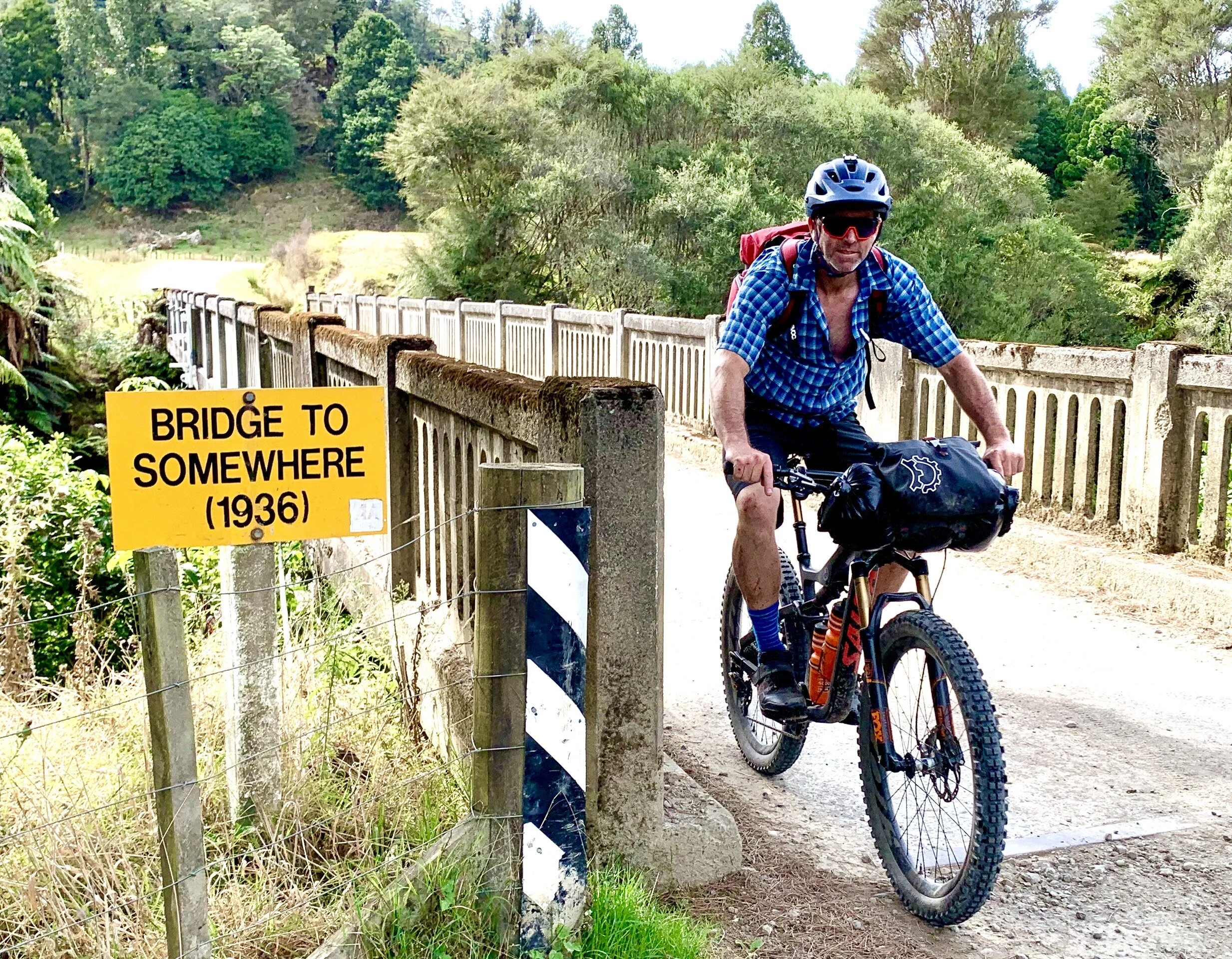
It was mid afternoon when we arrived at the famous bridge to nowhere. A construction project entailed in 1934 to bring prosperity to the Mangapurua valley with the promise the bridge would allow better access. After the settlers left, the bridge lay dormant in the bush for decades before a plan was hatched to link the bridge as a bike trail to the river at Mangapurua Landing. We rode on to the Landing and rigged up the boats for an evening paddle...it was getting late. A bunch of older folk were leaving in a jet boat, unknown to us at that time one of the passengers had fallen off the side of the track 20 metres down a bank out of sight from his companions. By the sounds he was very lucky not to have sustained serious injury and makes apparent the risk of beginner riders on powerful ebikes on technical, remote trails.


The paddle was surreal, glassy with beautiful light. We relaxed in the moment and enjoyed the serenity. We paddled up to the Lodge beach with the last light of the day, after quickly derigging were quickly overcome by the hospitality of Mandy, Joe and Wayne at the comfortably rustic lodge. This place really was an oasis. We were going to use the lodge as a launchpad for the most demanding sections to come.
I interviewed Wayne and Joe the next morning and really got a feel for the passion required to run a busy tourism operation with no electricity and requiring everything to travel by river. Wayne also put the fear of the Matemateonga track in me when he told me we would struggle with the rugged terrain. I was prepared for 300 vertical metres of hike a bike in the first 2 kilometres but the north island humidity hit me and I struggled to find a rhythm before we topped out for a shady lunch with expansive views over the towering Mt Ruapehu.
From here to our hut for the night was only 10 km but the going would be slow and filled with high exposure sections where a fall could have been fatal. We rode some amazing sections and hiked a lot too, I was dehydrated and incredibly focused on the narrow track, ensuring a pedal strike wouldn’t lead to a free fall into the abyss.
We were all stoked to see the hut after a long hot day through some of the most intimidating terrain I had come across. That night glowing from successfully achieving the challenges of the day I decided to get a drone shot of the tiny clearing of the hut surrounded by thick jungle. That was the last flight of the Mavic mini as it was lost to the forest with a power issue, due to the steepness of the terrain and impregnable vegetation it was pointless to try and recover it.


Day 4 shaped up to be another slow and technical affair. It was becoming obvious how historic this route was too, the track followed the ridge line continuously as this was the only way of traversing this terrain, departing from the high point would have led into a steepening gradient until it became a vertical precipice. It was easy to imagine the Maori iwi (tribes) moving along the ridge to trade with the river tribes or to make war too.
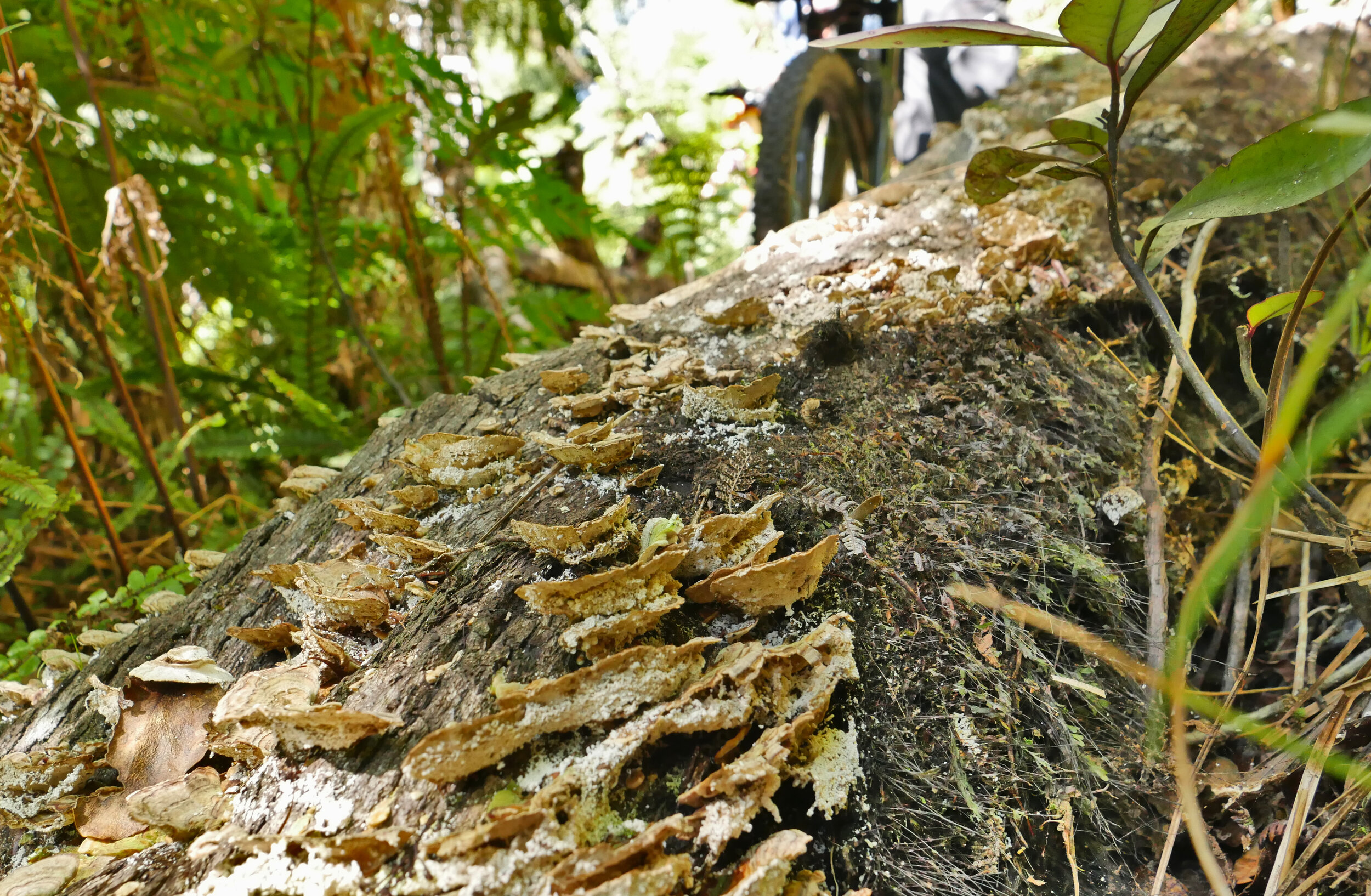
By now we were on a good rhythm of team travel, and the technical singletrack was awesome around the manky bits. The Matemateonga is a relatively little used track even by hiking standards, the hut journals showed very few mountain bikers, which was surprising I thought. We did have prime conditions and it would have been treacherous in the wet but it was fantastic backcountry bikepacking for more advanced riders on full sus trail bikes. The DoC huts were all 10 bunkers, were nice huts with rain water tanks and spacious common areas.
Day 5 meant the finish of the Matemateonga and a change of scene. We came to the first gravel road on the trip and we coasted down into the steep farmland of the Aotuhia Station, another locality example of early settlers endeavouring to break in this tough land decades ago. They even built impressive tunnels to circumvent steep ridge lines on the ramshackle road.
After a gradual climb for nearly 20km we arrived at civilization, a town! Whangamomona and old coal and rail town now on the ‘off the beaten track’, known as the Forgotten Highway, state highway 43 from Taumaranui to Stratford. We had booked into the pub for the night and when we checked in the nice publican walked us next door to the old post office done up period style into a motel room. Needless to say we made the shower filthy and set out to drink the pub dry, reality, had two pints a big burger and chips and fell asleep before 9pm.

Jackson and I had connected with the owner of a tourism outfitter, Forgotten World Adventures, that had developed a tour on the old disused railway using petrol driven golf carts on the tracks. Ian Balme has given us permission to strap our bikes to the buggy’s for the almost 50km to a spot we would be closest to our start point and leave us a 30km gravel ride back to Taumaranui.
It was pretty comical jamming our bikes in the back of a four person buggy but we made it work and we set off with the commercial tour of the day. The railway was once busy moving coal and timber and was also hoped to bring prosperity to the remote areas. It failed to come to fruition and the railway fell into a state of decay before Ian’s business brought it back to life offering a unique way of viewing the landscape.
The tour customers thought we were a bit crazy, there were some nice old ducks and we natted away when we got the chance. They waved us off after we built our bikes up and headed for the finish line. It was a nice cruisy undulating ride through sheep country, it was really hot and we had a 300m vertical climb to finish before the descent into town, it was brutal.

It seemed only fitting to call the film Forgotten Highways. We had travelled 6 old trails that had been highways at some point in history, be it Maori or European settlers all with similar enthusiasm for their endeavours as we were in the modern day to accomplish a challenge we set for ourselves. The toil we had endured whilst recreating would have been a drop in the bucket for what these hard men and women undertook to live off the land and even just travel through the landscape without the high tech bikes, boats and equipment we had available to us.
Were they forgotten? That depends on definition I reckon, maybe forgotten as ‘highways’, but this Awa and these trails are thick with heritage and folklore, legend and endeavour. In retrospect it seemed fitting to experience this area undertaking a degree of toil and some discomfort giving us the full immersion experience to the Whanganui District.